
Hello!
As you may know, I am preparing for my JMT hike this summer. I have recently picked up some gear and I wanted a nice gentle backpacking trip to test out some gear and get out into nature. I read about Mt. Sizer and thought that it would work perfectly for what I wanted. Sure, the reviews said things like “this is a difficult hike” and “not for beginners” but in my mind, hike reviews are to be taken with a grain of salt, because complainers will complain, whether on the internet or in real life, so I packed my bags and set off on an adventure!

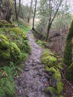
Well, the reviewers were right and wrong. This is not a hike for beginners, especially in early spring with a lot of rain. There is a LOT of altitude gain and several creek crossings that are fed by rainwater and can get pretty strong. I would not recommend this as a solo backpacking trip for someone who is brand new to backpacking, I would say to go with someone who knows what they are doing, or to be experienced yourself.

I started off my hike on a Friday in the late afternoon. It had been raining on and off all day, but just little bits of drizzle here and there, nothing to be afraid of. I started hiking at about 3:30 in the afternoon, after securing my permits and camping spots with the friendly rangers at the Henry W. Coe Park headquarters. (5 Dollars per night for camping plus 8 Dollars per night to park, first come first served, no online reservation available).
As soon as I started up the trail the small drops of rain started to bounce off of the ground, I knelt down and sure enough, it was hailing. Being a California native, this was almost an entirely new concept to me. Ice? from the sky? What do I do? Well, I did the only thing I knew how to do, I kept walking. And I put on a hat.
 Hail! and dry boots (spoilers)
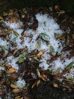
The hail stopped pretty quickly and I settled into a steady and comfortable pace. There was nobody else around, most Californians are afraid of the rain, making me a superhero of sorts (sarcasm). I kept on going along the trail until I arrived at the first obstacle: a creek crossing.

Now, I have crossed creeks before. This one could barely be counted as a creek. I have encountered puddles more “creeky” than this. No problem. I confidently stepped into the water and immediately felt the water soak through my boots and socks. I guess my boots were not quite as waterproof as I had assumed them to be. At this point, I was about halfway to my campsite for the night. I thought to myself, I can either turn back around face the empathetic looks of the rangers, or I can keep going and buy my poor feet a one-way ticket to Blister-Town. All aboard for Blister-Town! I trudged on.


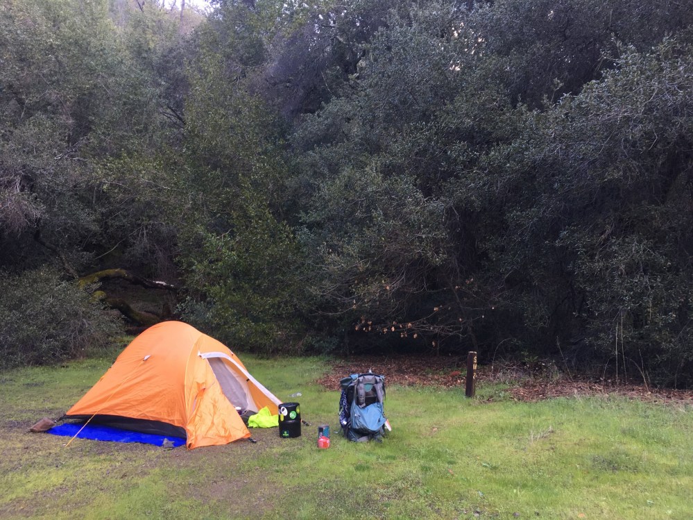
I got to my campsite, surveyed the area (empty, river nearby, lots of nice trees and grass, quiet, big hills in the distance) and took off my shoes and socks (not cotton thank goodness, learned that lesson!) then slipped into some clean dry socks equipped with foot warmers and cooked some dinner. I packed everything up and got into bed, nice and warm, just as it began to sprinkle again.
The next morning I woke up at around 4am to the sound of rain on my tent. I did a quick check to make sure that rain was not on the inside of my tent and went back to sleep. I woke up `for reals` at around 8am and because the rain had stopped, started to make breakfast. I boiled water for oatmeal and poured the extra water into my Nalgene, mixing it with a powdered electrolyte solution to make a kind of warm electrolyte tea. It was fantastic, I highly reccommend it.
I finished breakfast, reviewed my map and began to pack up my campsite for the day ahead of me. The rain came again while I was packing my bag, but I was not too worried about it. As soon as I finished packing up my bag and patted myself on the back for a job well done, I ran into a problem opposite of the problem Sherlock and John Watson run into in the punchline of this classic joke, which I have stolen from the internet:
Sherlock Holmes and Dr. Watson decide to go on a camping trip. After dinner and a bottle of wine, they lay down for the night, and go to sleep.
Some hours later, Holmes awoke and nudged his faithful friend.
“Watson, look up at the sky and tell me what you see.”
Watson replied, “I see millions of stars.”
“What does that tell you?”
Watson pondered for a minute.
“Astronomically, it tells me that there are millions of galaxies and potentially billions of planets.”
“Astrologically, I observe that Saturn is in Leo.”
“Horologically, I deduce that the time is approximately a quarter past three.”
“Theologically, I can see that God is all-powerful and that we are small and insignificant.”
“Meteorologically, I suspect that we will have a beautiful day tomorrow.”
“What does it tell you, Holmes?”
Holmes was silent for a minute, then spoke: “Watson, you idiot. Someone has stolen our tent!”
Unlike Holmes and Watson, my moment of realization came when I observed that while I was hearing the rain above me, I was not getting wet. Yep, I forgot to pack up my tent.
Because it was still raining and I had slept in a little bit, I decided to edit my route and head for the summit of Mt. Sizer, then instead of continuing on the loop trail, which included a more sizable creek crossing, (according to the ranger, it was up to mid-thigh on his 6 foot frame) I decided to play it safe and turn around after summiting, then go back and grab my (hopefully drier by that time) tent.

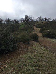
With this plan in mind, I waved goodbye to my tent and headed back up to the main trail following signs for Mt. Sizer: 2.6 miles. “Easy Peasy,” I thought.

Turns out the maps were right, these easy peasy miles were all uphill! Starting right after another legit creek crossing, with my boots soaked once again, I set out to conquer the infamous “shortcut” a zigzagging high climbing set of switchbacks and very steep incline. This section of trail has been rated as one of the most difficult in the Bay Area, and let me tell you, it really gave me a run for my money!

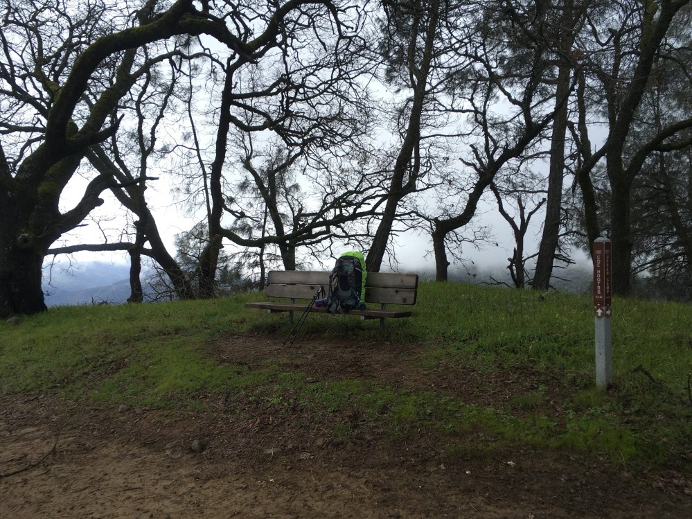
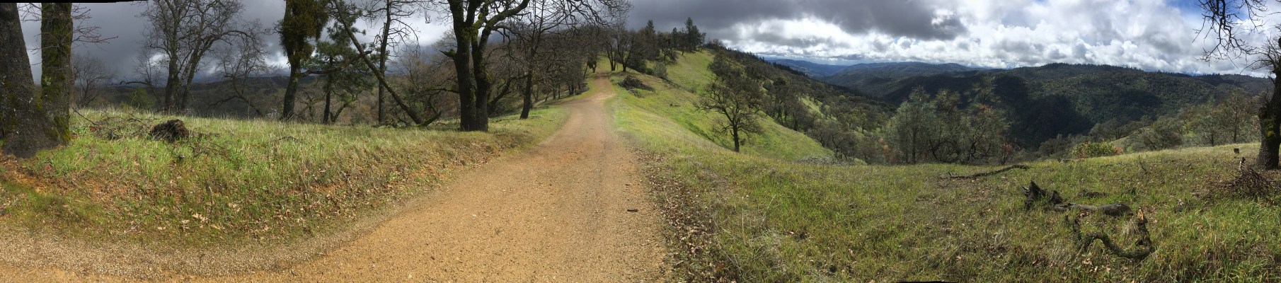
At the top, I connected to Blue Ridge Road and ate a quick lunch on a nice bench up there, until it started raining again.
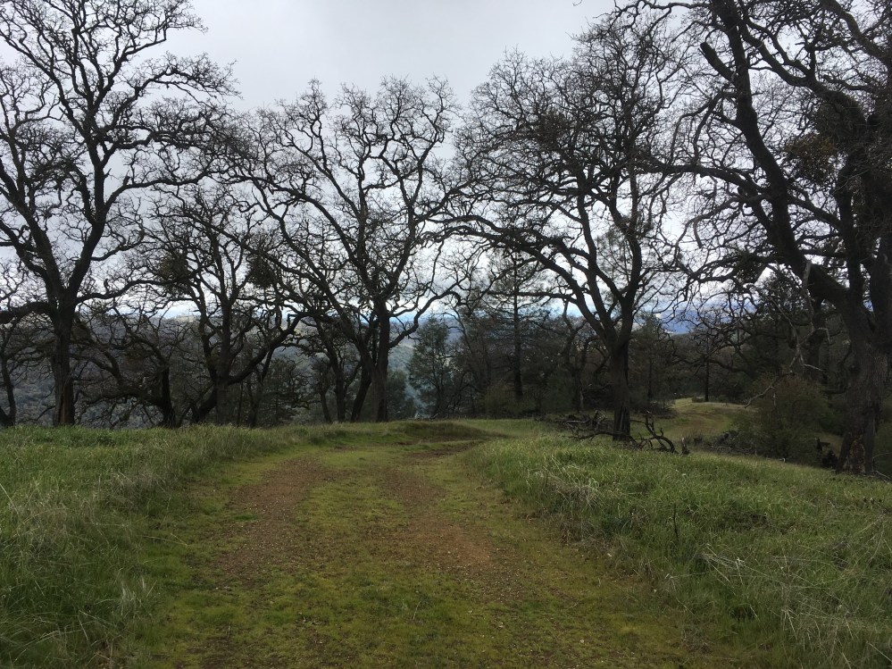
From there, it was a short hike, on mostly level ground, to the summit of Mt. Sizer. Interestingly enough, the summit of Mt. Sizer isn’t really very prominent. I think for this hike, the journey is really more important than the destination. The exact summit of Mt. Sizer is actually pretty difficult to place, but I took a selfie at the highest spot on the hill, where my topo map lined up with the “summit”.

Im smiling on the outside…but on the inside, well actually im smiling there too.
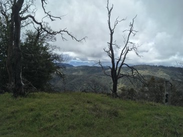
The view from the summit, or the summit-ish area, was beautiful. I arrived at the top when the blue sky was starting to break through the rain clouds, and it was wonderful! Totally worth the wet boots and general difficulties of the day.  My dino hiking buddy got quite the view as well!
After this, I headed back down to retrieve my tent. I passed a few day hikers on their way up the shortcut, then a few backpackers after I had recrossed the creek and resoaked my feet. One of the backpacking couples asked me about the weather and I told them that it had hailed several times, they were incredulous and did not believe me, until about 15 seconds after I told them about the hail when pellets of hail started raining out of the sky once again! I don’t think I’ve ever felt more like a weather controlling solo hiker goddess in my life, so I have to say that was a pretty cool moment!

During this trip, I definitely learned that I shouldn’t just assume that my boots are waterproof, so learn from my mistakes, always check before you go! I think I may invest in a nice pair of gaiters in the near future!
My stats for this trip:
Distance: 14.6 Mi
Duration (Hiking): 08 hours : 39 minutes : 22 seconds
Duration (Total): 25 hours : 01 minute : 44 seconds
Avg Speed: 1.7 MPH
Total Ascent: 4790 ft.
Highest Point: 3213 ft.


See my stats/map/more on Ramblr
Bonus pic, scroll down if you want to see what my crazy hair looked like under that protective beanie. (you’ve been warned)
Keep scrolling
or don’t…..
Alright, here you go:

Yikes! Stay away from this crazy hiker if you encounter her on the trails! 🙂
Till next time,
Pepper

Emma, this is one of your best posts so far. Informative, entertaining and very interesting.
I count it all joy! Sent from my iPhone
>
LikeLike